Saturday, 13 June 2015

The lights on the hill - A tribute to truckies.

It has been a while since my last blog post. I am starting to feel that the end of this first blogging period for me is close. Or maybe, the reason lies more on me being too busy on my new role, leading the Brisbane team of Veitch Lister Consulting. Strategic transport modelling is one thing that I wasn't too much involved in my career so far, so obviously I am learning a lot every day. Probably I'll have quite a few chances to write about transport modelling in future posts, either here in Mobility Management Australia or in another blog.


Today's post is something that I was heavily (!)  involved in my previous role. The pun is intended, as I am talking about heavy vehicles. Over the weekend I was visiting the rural town of Gatton. A nice little town to the west of Brisbane that has a transport interest as it hosts the Transport Museum. A well organised collection of old vehicles with a focus on trucks.


A big section of the museum is dedicated to Western Transport. This is not only a tribute to J.C. (Cyril) Anderson and his brother M.J.R. (Curly) Anderson, but also to the men and women who worked for this great company. In the early days of Western Transport, the group created a division to import, manufacture, maintain and market trucks. This led to the establishment of manufacturing facilities for Mack Trucks and Leader Trucks in Australia


And it is true that these 'pioneering' men and women and their heavy vehicles,  played a significant role in opening up the regional towns of Queensland and Australia. In extremely difficult conditions and travelling huge distances across the country they helped open up entire economic sections, like the oil and gas fields of Australia at a time when roads and certainly highways did not exist.

Source
I was more impressed, walking out of the museum for a walk across Lake Apex and the park, to come across the Lights on the Hill memorial. A  memorial wall for truck and coach drivers who have passed before their time, in a work related accident or by other means. People, that have contributed substantially to the Australian transport industry.


And that is when I remembered the tragic statistics around heavy vehicle and truck crashes in Australia. Almost 37 articulated and heavy rigid truck drivers were killed on average each year in Australia between 2008 and 2013.  Unfortunately, Queensland's share in these deaths is quite big, with an average of 11 heavy vehicle drives losing their lifes in Queensland roads from 2008 to 2011.

I am afraid that there isn't any other occupational category with so many fatalities each year. Imagine if 37 electricians or neurosurgeons were killed each year in Australia while doing their work. The public outcry would be enormous. So why aren't we more sensitive when it comes to "truckies"? I am sure that governments should do much more for this category of workers that on top of that are underpaid and have to work under huge stress. Otherwise, the drivers and their families will keep signing:
...
Oh, but I'm over the edge and down the mountain side
I know they'll tell about the night I died
In the rain when the lights on the hi-ill were a-blindin' me
....

Monday, 6 April 2015

Moving around South Island New Zealand.

A few weeks ago I had the pleasure to visit South Island New Zealand for a week of holidays.  I flew to Queenstown by a direct flight from Brisbane and then from there I embarked on a seven days road trip around the southern part of the island. You can see my day to day itinerary on the map bellow:


The South Island is an amazing place with a big variety of breathtaking landscapes. Driving around the island is fairly relaxed due to most roads having little traffic and is also quite pleasurable as the road network is diverse in characteristics and not monotonous. Lots of curves of different radii, uphill and downhill sections and of course the magnificent road environment and landscape allows the driver to drive long distances without feeling bored or tired.


Mountainous sections and sections across the Alps, ocean side sections and sections across the fields, they are all worth having a look. Plenty of spots of interest along the way, provide opportunities to stop, rest, enjoy lookout views and observe wildlife and livestock.


There are a few very interesting aspects of the South Island New Zealand road network. One that stands out is the single lane bridges. Most of the bridges along the peripheral route that I followed, were single lane narrow bridges. With low levels of traffic and without the very long and very heavy vehicles that we have in Australia, single lane bridges seem to work just fine. Just a few of them are very long, and these ones have usually one or more  pull-outs, so that you can pull your car aside if you happen to accidentally be on the bridge as another car is trying to cross it too.


One other very interesting aspect of the road network is the way New Zealanders do roadworks. I am not sure about the work health and safety statistics on roadwork sites, but it seems that they take a far more relaxed approach than Australia. Less people doing traffic control, use of automatic traffic lights to control one way traffic on roadworks sites and far less use of roadside protective barriers. The big debate about WH&S protection measures on roadworks sites and how those raise significantly the total cost may have an answer in a comparative analysis between the two countries.


But then again, looking at the picture above, maybe the solution for roadworks safety is somewhere in between the approach taken by the two countries.

Monday, 23 February 2015

Moving around Fraser Island.

Cyclone Marcia was the reason that we had to cut our family trip up the Queensland coast short. Unfortunately our visit to Agnes Water, 1770 and eventually LadyMusgrave Island at the southern end of the Great Barrier Reef will have to wait for another time. But we managed to complete our first visit to Fraser Island. The island’s native name is K'gari and it is a unique place listed as a UNESCO world heritage site that holds a significant environmental and cultural value.  It is the world’s largest sand island, made up of sand that Pacific Ocean currents carried from the rivers of Northern New South Wales and Southern Queensland.


It is an extremely beautiful place with a fairly unique and fascinating transport system. You can get to Fraser Island either by a small ferry or by a small plane. We chose to take the ferry from River Heads near Hervey Bay to Wanggoolba Creek named Fraser Venture. The other options to arrive to Fraser Island were to take a different ferry from River Heads to Kingfisher Bay or a ferry from Inskip Point near Rainbow Beach to Hook Point at the southernmost point of the island. All three ferries are very small and can carry only a small number of cars and trucks.


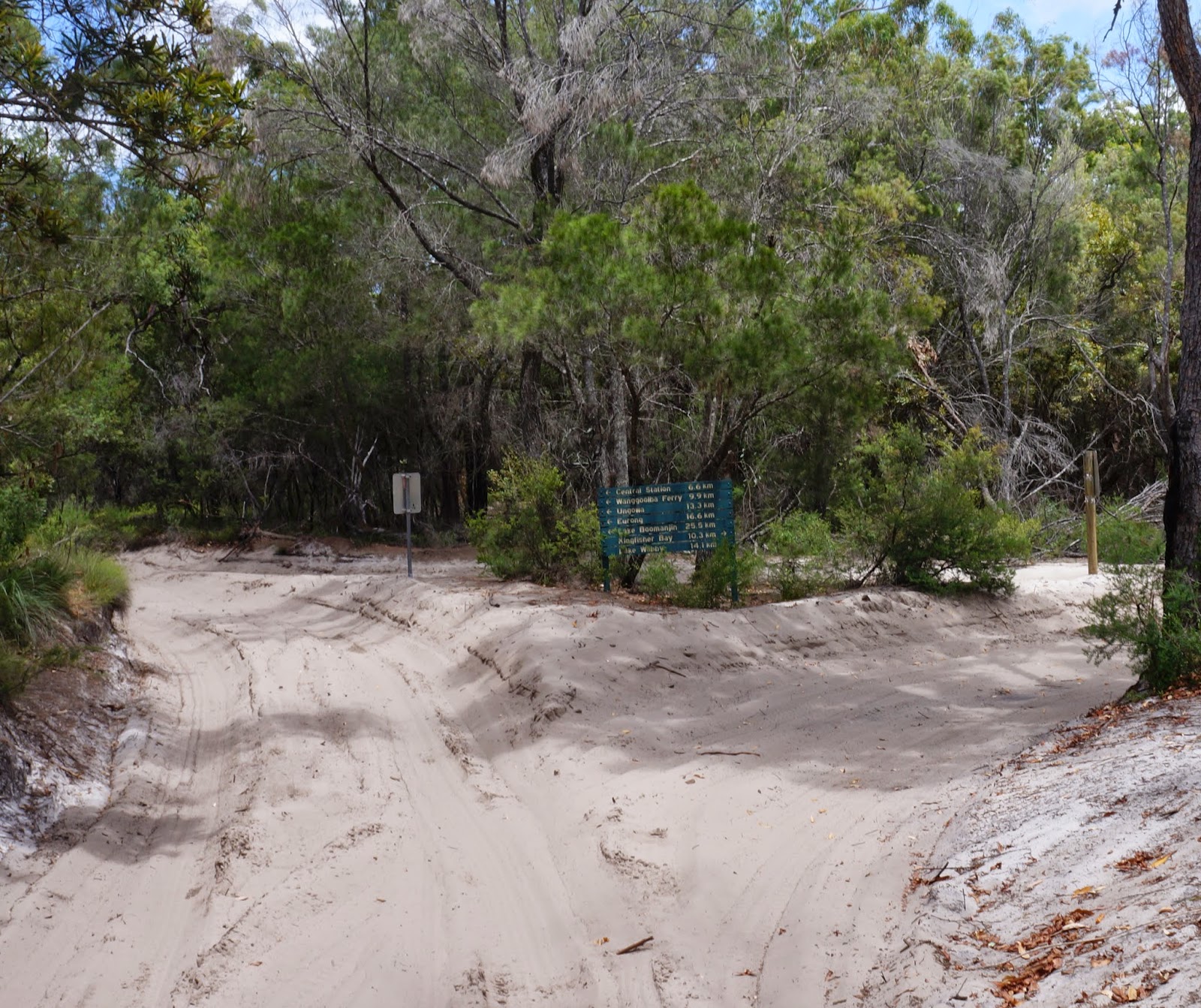
To drive around Fraser Island you need a 4WD and not just a 4WD but a fairly high clearance 4WD with low range capacity and preferably new and wide tyres.  You will also need a vehicle permit that can be purchased online or by phone. The road network in the island is all sand and it is divided in two very different parts: Inland sand tracks and beach.  Driving on them requires different vehicle setup and specifically different tyre pressure and 4wd gear range settings. It offers a very different driving experience, driving at different speeds and at a different ride roughness.


Driving off the ferry at Wanggoolba Creek we followed the sand track towards Central Station. Wanggoolba Creek was a Butchulla woman’s area and birthing place where men were excluded. While the name usually refers to a train station, Central Station is an old lodging village and the headquarters of forestry operations from 1920 until the late 1950s. No matter how wide your 4WD tyres are, you need to deflate them to around 20 psi (depending on the vehicle and tyre make). You also need to engage low range before entering the sand tracks.  We visited Fraser island outside the school holiday season so traffic on the tracks was not too heavy and we avoided too many encounters of opposing traffic on the narrow sections of the tracks. Driving on sand tracks has a 30km/h speed limit and all other road rules apply. In practice it is quite difficult to reach even that speed as most of the drive is quite bumpy due to underground tree routes that give a wave like look along the track.


Our next stop after Central Station was Lake McKenzie or as is known by its Aboriginal name Boorangoora. A sandy beach of almost pure silica gives an exotic – paradise like look to the place.  Next stop from there was the eastern beach.


When planning your trip to Fraser Island is good to know the tide times. Driving on the beach is only safe two hours each side of the low tide. Driving two hours each side of the high tide is extremely dangerous and lots of cars have been taken by the Pacific Ocean. Arriving at Eurong you should re-inflate your tyres to the suggested by the manufacturer pressure. Driving on the beach is much more like driving on asphalt road. The magnificent 75 mile beach is one of the island’s main attractions. The speed limit on the beach is 80kms/h but you have to drive very cautiously and be aware of beach goers, deep washouts from creeks flowing into the sea and light airplanes landing on that same beach that you drive. 


Of course in such a sensitive environment there are always concerns on whether the transport system of driving around in 4WD cars and buses is the most sustainable and eco-friendly solution. In the same time driving on the beach and on sand tracks has not been free of crashes. Turning the sand tracks into regular roads is next to impossible due to the distraction such a measure will bring to ecosystems and habitats. Even upgrading the existing tracks will attract more vehicle traffic, resulting in a spiral of more road degradation and more expensive maintenance. Ideas about alternative transport systems like a light rail system, have been tabled in the past but were never investigated in depth.